Online:Aldmeri Territory
< Elder Scrolls Online: Places: Cyrodiil / Subzones(Redirected from Online:Bloody Grasslands)
|
||||
|---|---|---|---|---|
| Zone | ||||
| Cyrodiil | ||||
| Location | ||||
| Southwestern Cyrodiil | ||||
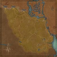
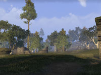
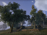
The Aldmeri Territory in Cyrodiil initially comprises the southwesternmost regions. The six keeps that make up the initial defenses of the Aldmeri Dominion are all located here. In addition, the towns of Vlastarus and Hackdirt can be found here, in the western section. The Imperial City lies across Lake Rumare to the northeast, but is inaccessible. The Daggerfall Territory is separated by a mountain range to the north on the western side, through which there are three gated passes. The Ebonheart Territory lies east across the Niben, passable via three defensible bridges. Swimming across the river or Lake Rumare is inadvisable, as they are both rife with Slaughterfish. There are three Dolmens here; Great Forest Dolmen and Greenmead Dolmen are found in the west, and the Nibenay Valley Dolmen is near the river in the east.
Bloody GrasslandsEdit
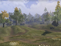
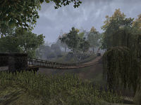
The Bloody Grasslands are situated in the northeast of the territory, southwest of Castle Alessia. The region consists of rolling fields and scattered trees and interspersed with the odd rocky outcrop. The region borders Lake Rumare at its northern end, where a bridge to the Imperial City can be found. The bridge is inaccessible due to the Daedric invasion, but an entrance to the Imperial Sewers is located just to the east along the shore. Sardavar Leed sits just to the west of Alessia, while The Atronach Mundus Stone is in the south of the region.
Colovian LowlandsEdit
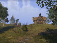
The Colovian Lowlands region lies between Castle Black Boot and Castle Bloodmayne in the south of the territory. The region contains rolling hills and valleys and descends from the northwest to the Larsius River in the south. A road runs along the northern edge of the region from Black Boot to Bloodmayne past Castle Faregyl, from which a second road heads north. Pothole Caverns is located on the south side of this road. The Apprentice stone and the Ayleid ruin Wenyandawik are located in the center of the region, while Clearwater Camp and Bloodmayne Cave sit beside the Larsius.
The Great ForestEdit
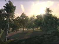
The Great Forest sits northwest of Castle Roebeck. A large wooded region, the Great Forest also contains the Imperial Nikel Outpost and a number of roads that lead south from the Daggerfall Territory border towards Castle Brindle and Castle Roebeck. The Great Forest Dolmen can be found in the north of the region, to the west of which sits Breakneck Cave. Haynote Cave opens out onto the southbound road to Vlastarus, just south of which is the Ayleid ruin Ceyatatar. A second Ayleid ruin, Narsinfel, is in the northwest of the region. In the west, just outside Castle Brindle, the road passes near Gottlesfont Priory, Wooden Hand Outlook and The Warrior Mundus Stone. Green Leaf Glade lies in the center of the region.
If you follow the road from the Priory Milegate as it forks northeast, continue halfway down that road then turn south and climb the hill. Atop the hill lies a dying tree and a ritual circle where the Nightweaver is casting a spell. A heavy sack lies near his ritual.
GreenmeadEdit
Greenmead is the region southeast of Castle Brindle and north of Vlastarus. The area is littered with old Imperial ruins nestled among the trees. A north-south road runs through the region from Ceyatatar past the Greenmead Dolmen and the village of Vlastarus to Nornalhorst. Just west of the village sit the eponymous Vlastarus Towers.
North WealdEdit
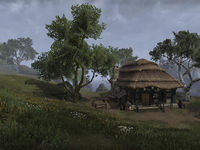
The North Weald is situated northwest of Castle Faregyl and southwest of Castle Roebeck. A primarily agricultural region, the North Weald contains a number of abandoned farms. A road running down the eastern side divides this region from the Bloody Grasslands, on the western side of which sits the Gray Viper Outpost. At the northern end of the region, where the road joins the Red Ring Road, the small village of Pell's Gate can be found. The Ayleid ruin Vindasel lies just outside Roebeck Farm.
Northern Niben ValleyEdit
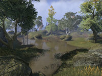
The Northern Niben Valley is the region south of Castle Alessia and north of Lunar Fang Docks on the western side of the Niben River. A number of secluded ponds can be found among the hills and valleys inland from the river, while the Green Road runs down the bank. The Culotte Bridge to the Ebonheart Territory spans the Niben just east of Riverwatch lighthouse. Atop the hills south of Riverwatch lie Moffka's Lament and Variela's Watchtower.
Southern Niben ValleyEdit
The Southern Niben Valley is the region northeast of Castle Bloodmayne and south of Lunar Fang Docks on the western side of the Niben River. The region descends southeastwards through rolling hills to the shores of Niben Bay. Spurs of the Green Road cross the region from Bloodmayne leading northwards, one of which leads across the Niben Bridge and into the Ebonheart Territory. The Nibenay Valley Dolmen sits in the center of the region, with Beriel's Lament just south of it. The Ayleid ruin Anutwyll lies on the shore of Niben Bay across from Bravil.
Southern WoodlandsEdit
The Southern Woodlands can be found south of Vlastarus and north of Castle Black Boot. The woodlands are a source of lumber for the logging industry, and a number of felled trees can be found in the area. A road runs southwards through the region from Vlastarus to the Abbey of the Eight, just beyond which sits the Abbey's lake, Blessed Water. On the western edge of the region lie Howling Cave and Silverscale Pond, as well as the Ayleid ruin Nornalhorst. A second Ayleid ruin, Juras' Fall, can be found in the east of the region. A secluded grove, Mist Mirror Refuge, lies in the south of the region, above which sits Thalara's Winery. Nisin Cave can be found just to the north. Beyond that, in the center of the region, a number of ruined buildings surround the Abandoned Orchard, just to the west of which stands The Lady stone.
Southwestern ShoreEdit
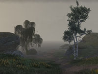
The Southwestern Shore of Lake Rumare runs from the border with the Daggerfall Territory around to the bridge to the Imperial City at the northern tip of the Bloody Grasslands. Covered in a perpetual mist, the southwestern shore encompasses the Ayleid ruin of Fanacasecul as well as the contemporary ruins at Virtue Outlook and Homestead Ruins.
Western RiseEdit
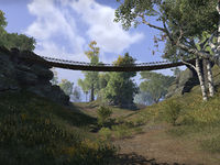
Western Rise is situated in the northwest of the territory, north of Castle Brindle. The region is named such for being the foothills of the Colovian Highlands which rise away to the west. A fault line runs along the eastern edge of the area across which a number of bridges provide access to the Great Forest. Serpent Hollow Cave is at the western end of one of these bridges. A road runs south through the region from the Chorrol Milegate on the border with Daggerfall Territory, past the Carmala Outlook to the village of Hackdirt. The village has been overrun with Black Daggers, and the former residents can now be found at a Refugee Camp just north of Brindle.
PlacesEdit
Major SettlementsEdit
- Vlastarus — A town in southwestern Cyrodiil, southeast of Castle Brindle. (map)
Minor SettlementsEdit
- Abbey of the Eight — An abbey in southwestern Cyrodiil, west of Castle Black Boot. (map)
- Gray Viper Outpost — A camp in southern Cyrodiil, southeast of Castle Roebeck. (map)
- Hackdirt — A town in western Cyrodiil, north-northwest of Castle Brindle. (map)
- Lunar Fang Docks — A small harbor in southeastern Cyrodiil, northeast of Castle Bloodmayne. (map)
- Riverwatch — A watchtower in southeastern Cyrodiil, east of Castle Faregyl. (map)
- Thalara's Winery — A vineyard in southwestern Cyrodiil, north of Castle Black Boot. (map)
Border Keeps, Artifact Gates and Scroll TemplesEdit
- Eastern Elsweyr Gate — A border keep in southern Cyrodiil, far south of the Imperial City. (map)
- Western Elsweyr Gate — A border keep in southern Cyrodiil, far south of the Imperial City. (map)
- Gate of Altadoon — The gate guarding the Scroll Temple of Altadoon. (map)
- Gate of Mnem — The gate guarding the Scroll Temple of Mnem. (map)
- Scroll Temple of Altadoon — The seat of the Elder Scroll of Altadoon, the offensive scroll for the Aldmeri Dominion. (map)
- Scroll Temple of Mnem — The seat of the Elder Scroll of Mnem, the defensive scroll for the Aldmeri Dominion. (map)
Keeps and OutpostsEdit
- Castle Alessia — A keep in central Cyrodiil, southeast of the Imperial City. (map)
- Castle Black Boot — A keep in southern Cyrodiil, south of the Imperial City. (map)
- Castle Bloodmayne — A keep in southern Cyrodiil, south of the Imperial City. (map)
- Castle Brindle — A keep in western Cyrodiil, west of the Imperial City. (map)
- Castle Faregyl — A keep in southern Cyrodiil, south of the Imperial City. (map)
- Castle Roebeck — A keep in central Cyrodiil, southwest of the Imperial City. (map)
- Carmala Outpost — An outpost in western Cyrodiil, north of Castle Brindle. (map)
- Nikel Outpost — An outpost in central Cyrodiil, southwest of the Imperial City. (map)
Imperial MilegatesEdit
- Alessia Bridge — A bridge in southern Cyrodiil, northeast of Castle Alessia, acting as a milegate between Dominion and Pact territories. (map)
- Ash Milegate — An Imperial milegate in western Cyrodiil, southeast of Fort Ash, on the border between Covenant and Dominion territories. (map)
- Chorrol Milegate — An Imperial milegate in western Cyrodiil, south of Chorrol, on the border between Covenant and Dominion territories. (map)
- Culotte Bridge — A bridge in southeastern Cyrodiil, west of Culotte, acting as a milegate between Dominion and Pact territories. (map)
- Niben Bridge — A bridge in southeastern Cyrodiil, northeast of Castle Bloodmayne, acting as a milegate between Dominion and Pact territories. (map)
- Odiil Milegate — An Imperial milegate in western Cyrodiil, southeast of Weynon Priory, on the border between Covenant and Dominion territories. (map)
Ayleid RuinsEdit
- Ceyatatar — An Ayleid ruin in southwestern Cyrodiil, east of Castle Brindle. (map)
- Fanacasecul — An Ayleid ruin in central Cyrodiil, north of Castle Roebeck. (map)
- Juras' Fall — An Ayleid ruin in southern Cyrodiil, west of Castle Faregyl. (map)
- Narsinfel — An Ayleid ruin in western Cyrodiil, north of Castle Brindle. (map)
- Nornalhorst — An Ayleid ruin in southwestern Cyrodiil, south of Vlastarus. (map)
- Sardavar Leed — An Ayleid ruin in central Cyrodiil, west of Castle Alessia's farm. (map)
- Wenyandawik — An Ayleid ruin in southern Cyrodiil, west of Castle Bloodmayne. (map)
DungeonsEdit
- Bloodmayne Cave — A cave in southern Cyrodiil, just southwest of Castle Bloodmayne containing giant insects. (map)
- Breakneck Cave — A cave in western Cyrodiil, southwest of Fort Ash, inhabited by the Black Daggers. (map)
- Haynote Cave — A cave in western Cyrodiil, between Castles Brindle and Roebeck containing Shadowed Path necromancers. (map)
- Nisin Cave — A cave in southwestern Cyrodiil, north of Castle Black Boot, featuring a sunken Daedric ruin. (map)
- Pothole Caverns — A cave in southern Cyrodiil, between Castles Black Boot and Faregyl containing Shadowed Path necromancers. (map)
- Serpent Hollow Cave — A cave in western Cyrodiil, north of Castle Brindle containing ogres. (map)
DolmensEdit
- Great Forest Dolmen — A Dark Anchor spawn point west of Nikel Outpost in western Cyrodiil. (map)
- Greenmead Dolmen — A Dark Anchor spawn point north of Vlastarus in southwestern Cyrodiil. (map)
- Nibenay Valley Dolmen — A Dark Anchor spawn point southwest of the Bay Bridge in southeastern Cyrodiil. (map)
Mundus StonesEdit
- The Apprentice — A Mundus Stone found in Reaper's March, Bangkorai, the Rift, and Cyrodiil. (map)
- The Atronach — A Mundus Stone found in Greenshade, Rivenspire, Shadowfen, and Cyrodiil. (map)
- The Lady — A Mundus Stone found in Auridon, Glenumbra, Stonefalls, and Cyrodiil. (map)
- The Warrior — A Mundus Stone found in Malabal Tor, Alik'r Desert, Eastmarch, and Cyrodiil. (map)
Points of InterestEdit
- Abandoned Orchard — A war-ravaged farm located east of Vlastarus in southwestern Cyrodiil. (map)
- Moffka's Lament — A graveyard located east of Castle Faregyl in southeastern Cyrodiil. (map)
- Vlastarus Armory — A workshop in Vlastarus where items in the Critical Riposte set can be crafted. (map)
- Wooden Hand Outlook — A ruined fortification found northeast of Castle Brindle in western Cyrodiil. (map)
Other LocationsEdit
- Homestead Ruins — The remains of a fort in central Cyrodiil, northeast of Castle Roebeck. (map)
- Howling Cave — A cave in southwestern Cyrodiil, south of Vlastarus. (map)
WayshrinesEdit
- Eastern Elsweyr Gate Wayshrine — A border keep in southern Cyrodiil, far south of the Imperial City. (map)
- Western Elsweyr Gate Wayshrine — A border keep in southern Cyrodiil, far south of the Imperial City. (map)
Unmarked LocationsEdit
- Anutwyll — A small Ayleid ruin in southern Cyrodiil, southeast of Castle Bloodmayne and just north of inaccessible Bravil. (map)
- Beriel's Lament — A ruined fort in southern Cyrodiil, east of Castle Bloodmayne. (map)
- Blessed Water — A lake in southwestern Cyrodiil, west of Castle Black Boot. (map)
- Bravil — A city in southern Cyrodiil, southeast of Castle Bloodmayne. (map)
- Carmala Outlook — A ruined fort in western Cyrodiil, south of Fort Rayles and just northeast of Hackdirt. (map)
- Clearwater Camp — A camp in southern Cyrodiil, southwest of Castle Bloodmayne. (map)
- Gottlesfont Priory — A chapel in western Cyrodiil, northeast of Castle Brindle. (map)
- Green Leaf Glade — A grove in western Cyrodiil, west of Nikel Outpost. (map)
- Mist Mirror Refuge — A grove in southwestern Cyrodiil, northwest of Castle Black Boot. (map)
- Nightweaver's Ritual Site (map)
- Pell's Gate — A ruined village in central Cyrodiil, east of Castle Roebeck. (map)
- Refugee Camp — A camp in western Cyrodiil, northwest of Castle Brindle. (map)
- Silverscale Pond — A lake in southwestern Cyrodiil, southwest of Vlastarus. (map)
- Variela's Watchtower — A ruined fort in southern Cyrodiil, east of Castle Faregyl and just southwest of Moffka's Lament. (map)
- Vindasel — A small Ayleid ruin in central Cyrodiil, northwest of Castle Roebeck and just west of Roebeck Farm. (map)
- Virtue Outlook — A ruined fort in central Cyrodiil, north of Castle Roebeck and just southeast of Fanacasecul. (map)
- Vlastarus Towers — A pair of ruined towers in southwestern Cyrodiil, west of Vlastarus. (map)
- Western Larsius River — A small area in southern Cyrodiil west of Scroll Temple of Mnem and just southwest of Clearwater Camp. (map)
