| Silver Road | |
|---|---|
| Type | Road |
| Continent | Tamriel |
| Province | Cyrodiil |
| Appears in | Oblivion |

The Silver Road is one of the major colored roads of Cyrodiil, branching the main circle, the Red Ring Road to the south with the hinterlands of County Bruma and the provincial border in the Jerall Mountains. It is a tricky path that scales up the mountains and trickles through the lush wood of the Great Forest and the Jerall valley.[1]
GeographyEdit
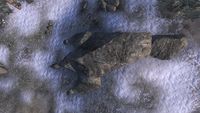
The road starts on the north side of the Red Ring Road, at an intersection where the ruins of Sercen are located. From there it travels north through the Great Forest and up the hill. Along the way it passes the Thief Stone, one of the Standing Stones of Cyrodiil, as well as the town of Bleaker's Way and the ruins of Anga. The road starts to zig-zag until it reaches a fork in the road where an Oblivion Gate had appeared during the Oblivion Crisis of 3E 433. There is also a cave called Toadstool Hollow here. Here the road diverges two ways, one it continues north into the Jerall Mountains, or west into the Orange Road, which leads straight to Chorrol.[1]
The Silver Road continues north into the Jerall Mountains and County Bruma. The road turns into a valley that splits the county seat of Bruma from the snowy peaks of Gnoll Mountain. Just off the road is a Hestra Rune Stone and an abandoned silver mine. During the Oblivion Crisis, one of the Great Oblivion Gates opened next to the Silver Road outside of Bruma. The remains of that battlefield are still present and the abandoned siege crawler remained even after the gate was closed.[2] The Silver Road continues north until it officially ends at Dragonclaw Rock, but here is where the road diverges again.[1] If you continue past the rock, you will go down an unmarked road that passes the Sentinel statue and arrives near the Serpent's Trail and even the Pale Pass toward Skyrim. If you travel east than you go down another unmarked road that goes around Gnoll Mountain and reaches the outer territories of County Cheydinhal.[3]
The Silver Road served as a supply route for the Imperial Legion during the Great War in the Fourth Era. By the end of 4E 173, the Imperial City was surrounded on all sides except from the north and their connection to Bruma on the other side of the Silver Road. Emperor Titus Mede II broke out of the Imperial City with his armies and rendezvoused with the Legion coming south from Skyrim. They later descended down the road for the Battle of the Red Ring, where they later claimed victory over the Aldmeri Dominion.[4]
In maps from the Imperial Simulacrum, the Silver Road had extended past the provincial border and into Skyrim.[5] Based on other maps, the road eventually led to the village of Riverwood in southern Skyrim.[6]
GalleryEdit
-
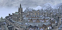
Bruma
-
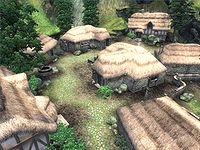
Bleaker's Way
-
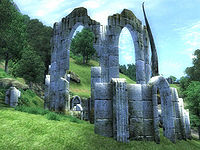
Sercen
-
Dragonclaw Rock
-
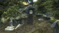
Toadstool Hollow
-
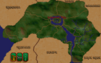
Map of the Imperial Province


See AlsoEdit
- For game-specific information, see the Oblivion article.
ReferencesEdit
- ^ a b c Silver Road location in Oblivion
- ^ Defense of Bruma story quest in Oblivion
- ^ Bruma — Cheydinhal unmarked road in Oblivion
- ^ The Great War — Legate Justianus Quintius
- ^ Map of the Imperial Province – The Elder Scrolls: Arena
- ^ Map of Skyrim – The Elder Scrolls: Arena