File:DF-map-Iliac Bay Temples and Knights.png

Size of this preview: 800 × 464 pixels. Other resolutions: 1,024 × 594 pixels | 1,952 × 1,132 pixels.
Original file (1,952 × 1,132 pixels, file size: 331 KB, MIME type: image/png)
SummaryEdit
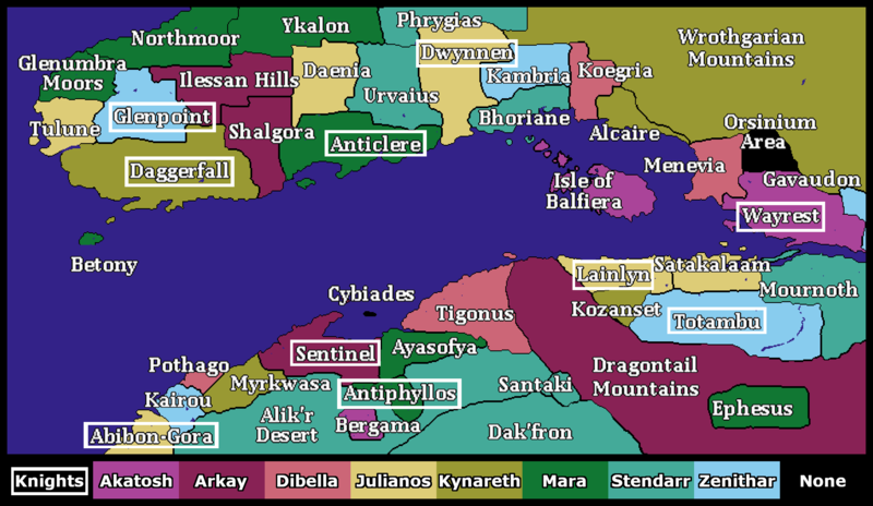
A map of the Iliac Bay indicating the dominant Temple in each region using a color code. Additionally, regions with Knightly Orders have boxes around their names.
LicensingEdit
 |
This image was created for use on UESP using components taken from the Elder Scrolls series of video games or from websites created and owned by Bethesda Softworks. The copyright for the components is held by Bethesda Softworks while the copyright for this particular composition is held by UESP. It is available for use under the same Attribution-ShareAlike 2.5 License as our text content. For further details, see our copyright policy. |  |
File history
Click on a date/time to view the file as it appeared at that time.
| Date/Time | Thumbnail | Dimensions | User | Comment | |
|---|---|---|---|---|---|
| current | 09:34, 8 August 2022 | | 1,952 × 1,132 (331 KB) | Zunk (talk | contribs) | A map of the Iliac Bay indicating the dominant Temple in each region using a color code. Additionally, regions with Knightly Orders have boxes around their names. Category:Daggerfall-Map Images |
- You cannot overwrite this file.
File usage
The following page links to this file: